Ganora Guest Farm Cycling - Nieu Bethesda
- Nieu Bethesda
Last Updated: March 2020
Contact Hester & Jan-Peet Steynberg
- 049 841 1302
- 082 698 0029
- 086 505 4184
- info@ganora.co.za
- Visit Website
- Follow on Facebook
Location
- Longitude: 24.591797
- Latitude: -31.854614
- Map
About Ganora Guest Farm Cycling
Ganora Guest Farm Cycling Trails
You can choose to do easy rides, setup by Soeren Mades, near the homestead or try something a little longer. There are two marked trails on the farm that are accessible to mountainbikers, although some level of experience is recommended. Trails numbered 3 and 4 allow mountainbikers to explore the Karoo landscape the farm has to offer. You will need double shocks and a puncture kit for the longer ones. You will be biking through our springbuck camp and will surely be able to see some close by. Please bring your own bike along.
Recently Lucas Dreyer, from Pretoria, surprised us with a detailed review of his experience he had on a route of 62.3km JP suggested to him. This info will surely entrigue the more serious mountain bikers. It has as much detail in as you will ever need! Read about it below under "JP's Loop".
biking.jpg
Trail 3
Distance: 11.6 km.
Duration: 1 hour biking
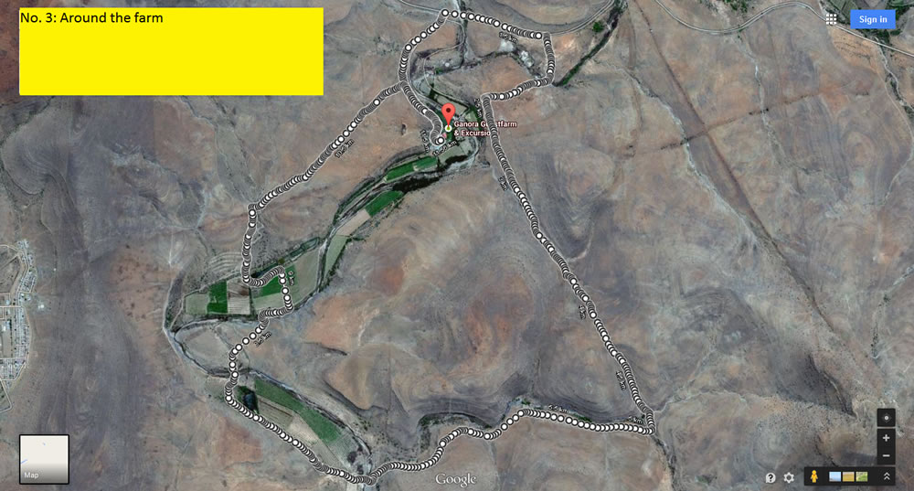
Trail 3 forms a loop around the farm, and bikers will cross rocky hills as well as sheep pastures. At certain points bikers may have to lift their bikers over sheep gates if locked and over streams depending on the rain, although these streams are very narrow and easily crossed.
Trail 3 Map

Trail 4
Distance: 19.7 or 21.3 km.
Duration: 1.5 to 2 hours
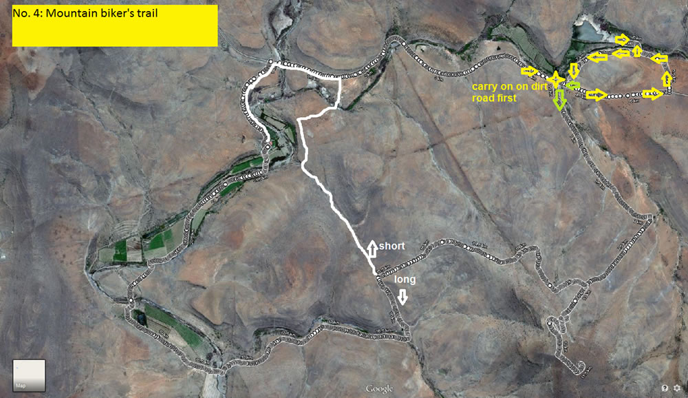
Trail 4 leads to a mountaintop on the farm from which bikers may view Compassberg in a spectacular panorama. The trails begins on a dirt road and passes a dam where bikers may see flamingoes depending on the season. As the trail ascends the mountain, the path becomes rockier. After reaching the summit, bikers have a choice of a longer or shorter route back to the main farm area.
Trail 4 Map

JP's Loop
62.3km
808 m gain
200W Estimated average power

Lucas wrote:
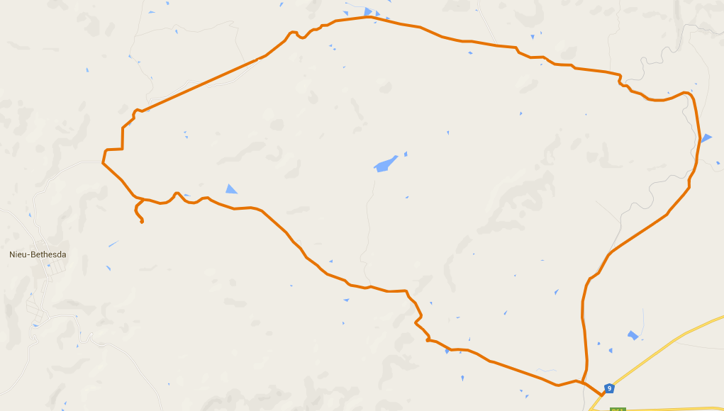
I asked JP if there was a scenic 60-80km section of dirt road and without hesitation he pointed me in the vicinity of Sneeuberg. (See Google Map and downloadable KMZ and GPX files below)
I underestimated the beauty that would unfold in this exploratory ride and wanted to pay tribute to JP by naming the ride and sections after its chief navigator.
Be prepared to go out early, preferably sunrise. The temperature very quickly becomes a test in itself and make sure you have enough water.
Preparation wise this is not a casual ride. There are two climbs that will help you understand that the Karoo does have some climbs to take note of.
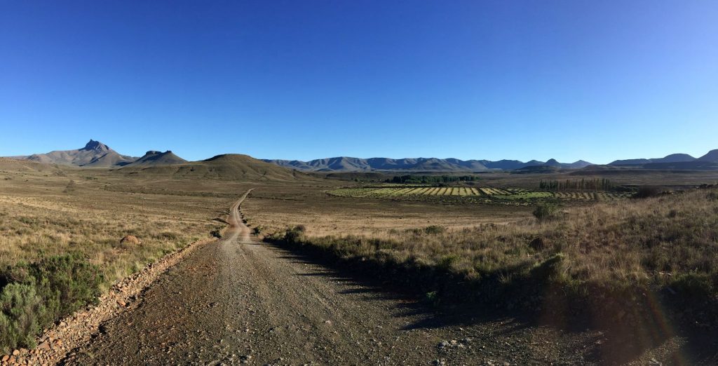
The views are spectacular, I stopped many times to take some Pano shots and took some GoPro footage on the faster descents. The surface was all-round good with loose rock on the latter part of section two.
The ride is broken up into three distinct sections:
Segment 1: JP se loop (Ganora tot bo)
22.6km
377 elevation gain

The air is crisp and you are warming up on this rolling segment that has Compass berg to your left for the majority of time.
As you enter Sneeuberg reserve you will encounter Springbok, Zebra and Wildebeest.
A steady climb will see you reach the highest point of the ride (1744m)

Segment 2: JP se loop (Mynskag na N9)
18km
341m

This segment leads you into a South Eastern valley that stretches as far as the eye can see. Be prepared for some speed if you are willing to select the longer gears. Old railroad crossings remind you of the bygone era of transport logistics.
Segment 3: JP se loop (N9 na Ganora)
20.4km
350m elevation gain

This section will be uncomfortably hot if you did not manage to start early enough. It starts at the N9 turnoff to Nieu-Bethesda and a quick glance up the valley will remind you of the constant climb to reach your destination. A few 12% grade climbs in short succession but elation once you reach the top and from there on it is all downhill. Watch out for the dry riverbed crossings that has some thick sand, keep it straight and peddle hard.

Here are the *.gpx and *.kmz files.
This ride was special due to the fact that I had no expectation. I will be sure to return and better some segments of my own. Happy riding!
One last option is to bike from the farm to Nieu Bethesda
Distance 8.6km
Elevation: 104m

Map and Directions to Ganora Guest Farm Cycling
Directions
Just before entering Nieu-Bethesda from Graaff-Reinet turn right onto the pink brick paved bridge. Turn right at the second 4 way stop. Into Hudson street. Turn left at the third street (Naude Street) with a small sign to Middelburg, Cradock and Nieu-Bethesda station. After 5km you will find a turn off to the left which you can ignore. 2km further you will find the GANORA GUESTFARM & EXCURSIONS sign on the right-hand side. 1km after turning right you will find our homestead.
When coming from the North - Middelburg: 2km after you see the "Gods Motel" sign on your right-hand side (halfway to Graaff-Reinet on the N9) turn right at the Nieu-Bethesda sign. After 20km you will see our sign on the left hand side. 1km after turning left you will arrive at our homestead.
When coming from Cradock: Turn right at the T-junction (towards Middelburg). After 600 meters turn left towards Nieu-Bethesda for 20km. Turn left at the GANORA signpost and you will find our homestead 1km further on.


